Tuesday, July 19, 2011

HS 100

The Hot Springs 100 is an adventure race that begins at Chena Hot Springs, AK and ends at Circle Hot Springs, AK. A few months ago Julia's old ski coach mentioned he was interested in making a go of it. I immediately expressed my desire to try it as well. So we started planning for it.

Below is the driving route.


View Larger Map

Because we had to go by foot, Scott and I took a shorter route. Prior to the race we had many conversations while planning our route. We spent hours looking at quadrangle maps and google earth. I created a series of waypoints for my GPS unit that we could use to navigate when our direction became obscured by weather, foliage, or terrain. Scott brought maps of the areas we planned to pass through. We were darn ready for a challenging race.

In the 4-5 days leading up to the race, I ate a lot of food. Four boxes of macaroni and cheese, four lbs of cereal, nearly two lbs of dry pasta, and all sorts of other stuff disappeared from the shelves.

Two days before the race I started to consume my secret weapon.
I ate an entire pie in 24 hours.

We had a goal of finishing in less than 30 hours. This seemed reasonable but we knew that a lot had to go right for us to make it. A long stretch of up and down from the Far Mountain Trail to Birch Creek was difficult to interpret on the maps and satellite photos. Water was not particularly abundant on our route. But the weather was slightly overcast and cool and we were optimistic.

Pre-race photo courtesy of Mike Welsh.

Leaving Chena Hot Springs at the start of the race. We were never
really in the lead. 

We got ourselves up onto the Far Mountain Trail and pushed along at a very good pace, nearly 3 mph, considering the number of climbs along the trail that exceeded 500 feet. After about 2 hours we had completely dropped all the racers who had decided to take the same route as we had. That was encouraging.

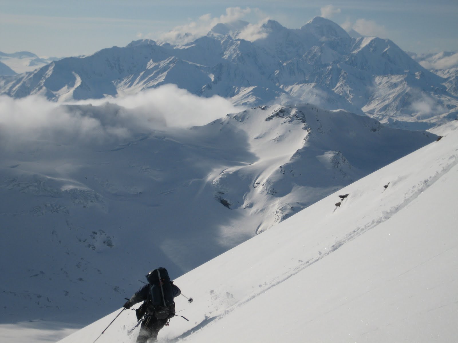
Scott making the last climb before we left the Far Mountain Trail
and headed off into the unknown.

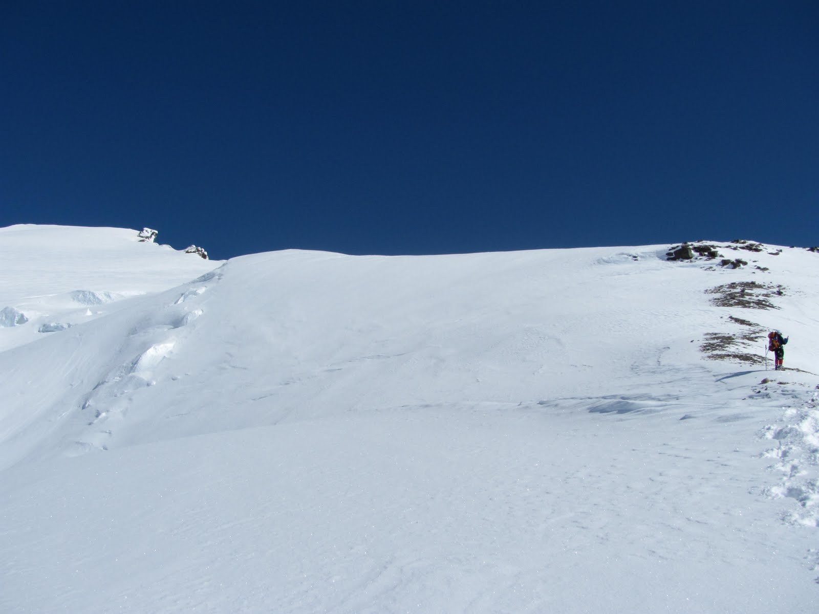
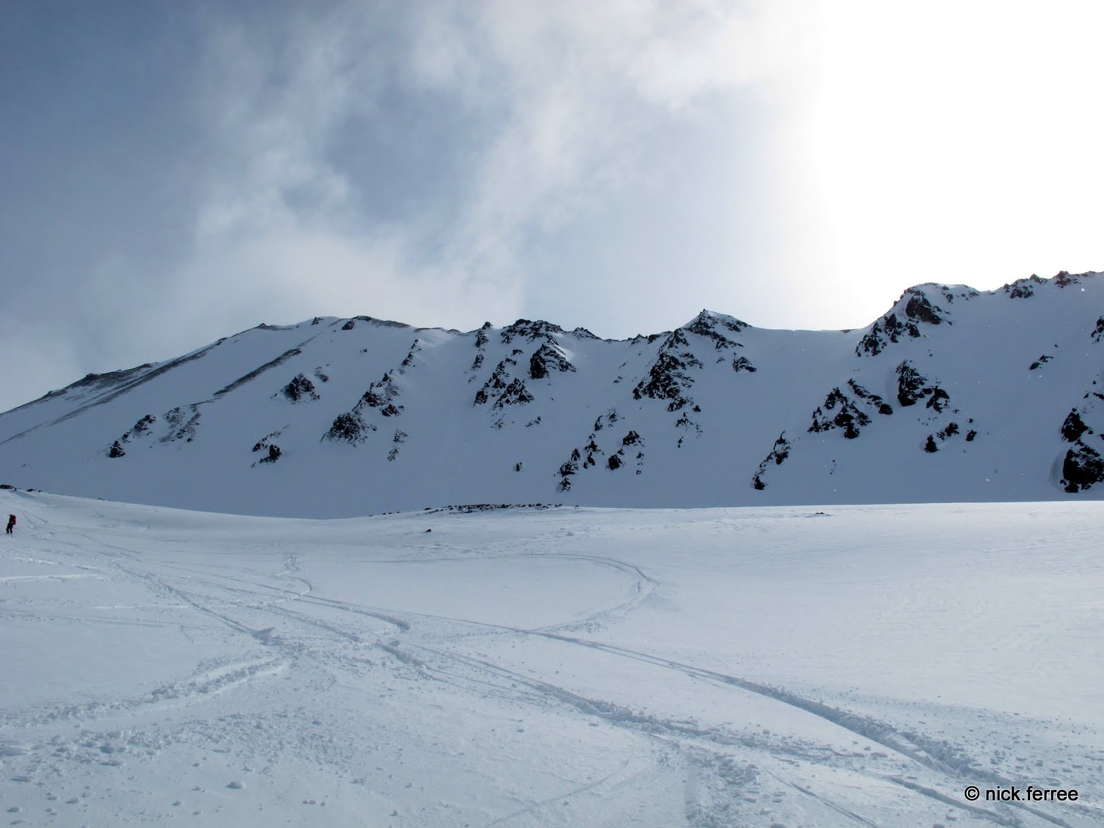
The top of Far Mountain Trail looking NNE.

Dropping off the Far Mountain Trails was not a little steep and my feet began to hurt. Blisters. Neat. This was a bit disappointing since all of the previous hikes in the months leading up had produced no blisters whatsoever. Whatever. I had decided not to take off my backpack for the first 30 miles, until we reached Birch Creek. A quick adjustment of the socks and catch back up to Scott. Backpack was still on 11 miles in.

Around 1:00 PM as we started into the first area below the tree line that did not include a man-marked trail, we came across one of the more exciting discoveries of the route we had decided to take. There were game trails everywhere! And they were heading in more or less the same direction we were hoping to go. Some trails were better than others. We found that caribou trails were far superior to moose trails. But most reduced the amount of bushwhacking so significantly that a finish time of less than 30 hours was not so difficult to imagine. We were making incredible time through what I anticipated to be the roughest parts of the trip.

Game trail! Caribou make the finest trails around. 

For the next six to eight miles we followed the ridge between two drainages, following game trails through the brush and enjoying the tundra above the tree line on the exposed ridge.

Above tree line with the wild flowers.

For the next several hours we moved along quickly, up and down between forrest and exposed tundra. This was an incredible few hours. The breeze cooled us off as we moved along at a 2-3 mph pace, the views were wonderful, and the game trails were a joy. The trails would appear and disappear in the brush and finding and keeping them was a wonderful mental challenge that diverted attention away from sore feet and tired legs.

One of my favorite moments of the trip.

Scott and I discussed the route often, making both macro- and microscale decisions. We also had plenty of time for silent trudging. Though there was a possibility that the guys we saw during the first two hours of the hike were only a few miles behind us, there was a distinct feeling that we were isolated and alone. On quiet moments throughout the duration of the trip I recited a wonderful Easter poem I recently memorized and several other songs describing how great God is, most from Hope College chapel services. There was enough time for four or five recitations of each song I could remember. A happy time on the trail.

And there was a continuous breath of very fresh air. There are more spectacular adventure race courses and routes but the satisfaction of being out in the wilderness was overwhelming. We did not see many rocky cliffs but what we did see caused me to lift my hands in joy and appreciation.
Enjoyable terrain. Spectacular even.


The game trail below marked a profound high point around 8:00 PM. We were hours ahead of where we planned to be and what we could see ahead appeared to offer fast travel where 2-3 mph was not unreasonable.

Finding a unobstructed game trail caused me to shout and laugh with happiness. 

We were reaching about 12 hours of constant moving and coming up to 27 miles of travel. I had not stopped to take off my backpack (Ha!). Around 10:00 PM, I started to think about strange things to keep my brain going. Such as what the overall effect of the mosquito that I had just sucked down had on my hiking performance. Should I try to spit out a mosquito if it finds itself in my maw? Is eating it going to lead to faster hiking or slower hiking? I know there is at least a little bit of caloric value in a mosquito. But would that energy from the mosquito be useless as more energy is required to process the mosquito and move the undesirable pieces out the other end? Mosquito eating: helpful or hurtful?

We followed an ancient two track put in along a ridge, possibly involved in wildland fire fighting in decades past, where Scott found a useful moose trail that offered good footing. The two track/moose trail spit us out into a field tussocks that appeared very long, 1-2 miles. Not ideal. Tussocks are pretty much cursed at by any backcountry traveler, before, during, and after any experience with them. They generally involve twisted ankles and soaking wet feet. We plodded on, still holding onto a moose trail headed in the same direction we were attempting to head.

*;^%$#$%^%^*;. It's all tussocks. Tussucks.

Also at this point Scott was running low on water. We had found small patches of water along the trail but had been repulsed by the caribou feces and mosquito larvae floating and swimming about. Near this first tussock field, Scott had an excruciating experience with hamstring cramps. He stopped walking, started screaming in pain, fell on the ground, and laid there until the cramps let up. Interesting development.

Working through the first field of tussocks. Not encouraging.

Keep on.

A small wildland fire from the tussock ridge. Kind of neat.

Around 12:00 PM we were ready to dive into the next tussock field. As we worked towards the border of the field through an old burned out stand of small spruce trees all the crap that could hit the fan seemed to hit it. In addition to having a few more debilitating hamstring cramps, Scott was starting to feel nauseous. Food was not appealing at all and very little potable water was left between the two of us, which was about the only thing he appear to be able to keep down.

Right about then I notice that my GPS unit was not in its pocket on my backpack belt.

%^!@$^*;*@^!$%^;*I()(*^%$!?!!?!?

I had dropped it within the last 10-15 minutes. We were picking our way through a maze of burned out trees and tussocks. Our previous path was essentially invisible. I mentioned to Scott my idiocy. He laid down in a grassy spot and didn't move for the next 45 minutes while I attempted to retrace our steps. I took off my backpack for the first time since shouldering at the start of the race 14 hours earlier. Dang it.

This was helpful for Scott. I asked him to blow a rescue whistle he had every minute or so to help give me a reference point as I searched for my GPS. Later he told me that it took everything in him just to take a deep breath and blow the whistle. Things were not going well at this point. The loss of the GPS was not a race breaker (and we couldn't really turn around and retrace our steps anyway). The weather and visibility were both very good and we knew our route well. But we needed some water sooner rather than later.

I surrendered my GPS to the wilderness and returned to Scott sprawled in the tussocks. He hadn't moved at all for nearly an hour except to blow the whistle. We put the packs back on and began to move on to the next great field of tussocks. Almost immediately Scott experienced another hamstring cramps, falling back to the ground and screaming in pain.

Time for a change of plans. Down off the ridge we planned to follow all the way to Birch Creek to our southeast was more flowing water called Clums Creek. Instead of shooting for Birch Creek we decided to head for the closest water possible. Scott believed he could make it the mile or so down to the water. I picked through the brush and tried to find a route that involved as little use of the hamstrings as possible. This was difficult to do.

After traveling less than a quarter mile Scott had a few more cramps. I had been praying silently that his cramps would hold off long enough for us to get to Clums Creek. Finally I said aloud something to the effect of, "God please keep Scott from cramping so that we can get to the creek." I gave him all the water I had and he got up and we started started moving down the slope. No more cramps for the next half mile or so and we were dunking our water bottles in the nice clear creek and sucking down as much water as we could hold. Thank you God.

Thankfully the type of crap that hits the fan involving dangerously close animal encounters had not hit the fan, and it never did throughout the entire trip. That's sweet. Kind of. It would have been fun to see something or other. Some racers did run into a few large mammals.

Our put in on Clums Creek. Somewhere around 2:00 AM. 

We took our time on the banks of Clums Creek. Earlier we were discussing 15 minute stops to get the boats inflated and off down the river. We ended up spending about an hour getting water and food put in ourselves and the boats loaded up and ready to go. Scott felt much better after drinking as much water as he could handle.

Eventually we bundled up, hopped in the boats, started downstream, and got out of the boats at the first snarl of sweepers 50 yards downstream. Neat. We played this game for about 3 hours. We also found ourselves regularly bouncing along rock bars as we worked our way downstream, trying to find the deepest route down Clums to Birch Creek. It was kind of cold too. Ice formed as water splashed on our backpacks strapped to the bow. We scraped our way down, finally arriving at the confluence and entering Birch Creek around 5:00 AM.

Larger creek!

We learned later that this was one of the lowest water years in the past decade. Thus, not only were we were dragging butt on the rocks, it was relatively slow moving. We scraped our boats along, searching for a nice deep channel, getting out and soaking our feet in the creek for a while when we got stuck.

A few exciting spots on the river kept us awake. Just before the obvious Shotgun Rapids were two large boulders with a bit of a drop that we bounced past. That kept us awake. Also, we saw a couple of racers asleep in their boats just before the rapids. Aside from some folks waiting for racers to come down the road about one mile from finish line, they were the only humans we saw the entire race. Heck yeah we were passing them.

Shotgun Rapids. Portage river left.

I was kind of cold. When we portaged Shotgun Rapids I found that getting out of the nice warm boat with a spray skirt was unpleasantly cold. I sat in a puddle of water that completely soaked my lower body while in the boat but taking off the spray skirt and getting out was the most difficult part of the morning. My legs were shaking uncontrollably, muscles throughout my body were contracting randomly, I had a lot of trouble staying upright while walking on the uneven rocks on the bank of the creek, and the mental process of putting my boat in the water and then getting in it was really hard to put together in the right order. I guess that is what some people call moderate hypothermia. I call it part of the deal. Spray skirt closed, problem solved. Is that stupid or tough?

Scott hopping in the boat after portaging Shotgun Rapids.

We bounced along for another three or four hours after the rapids. On one particularly straight calm portion of the river I fell asleep for what seemed to be about 10 seconds. At that point I suggested to Scott that we set a goal for when we wanted to reach our takeout. He agreed and I started paddling hard, trying to reach our take out by around 11:00 AM or something like that.

Birch Creek paddling.

Eventually we bounced the 20 or so miles down Birch Creek to Pitka's Bar where we hopped out of the boats and onto dry land.

Tak for turen!

Kind of dry land. My feet had been soaked for the past 12 hours. Also, they were a bit blistered. Time for a large dose of mild anti-inflammatory medication.

We collected our completely soaked items into our packs and headed up towards the ridge we planned to follow in order to avoid a bushwhack up a creek that most racers take. As soon as we crested the bank, we noticed a tussock field about a mile long. Neat. We crossed the tussock field and started to climb through the woods to the exposed ridge. Many thanks were again due to the caribou for carving trails through the woods.

The wispy clouds of the previous day gave way to rain clouds blowing in from the west. So the camera went away for a while. This was relatively challenging hiking. Though we had changed socks at the takeout, everything was soggy. We followed a four-wheeler trail for about 5 miles along the ridge, eventually making a final bushwhack to a gravel road that marked the final stretch. At this point, both feet were feeling pretty well shredded. Since taking out at Pitka's Bar, both heels and the balls of my feet felt like they were completely covered by a blister; one big one on the heel, one big one on the ball of my foot.

I convinced Scott that I heard voices on the road behind us (kind of true; I heard something) and that we needed to keep a brisk pace to stay ahead. A bit more than four more miles of walking put us at the finish line.

Finish line in sight.

We signed in on the finish line sheet and called it good.

Done.

Scott had arranged for some of Julia's old teammates to pick us up between the hours of 6 and 8 PM. We had joked on the last hour of hiking that it would be a bit disheartening to be just a bit too late, see them pulling away, leaving us to figure out a way home that night. Didn't happen. Good thing too. Dry shirt, pants, and socks have never felt so good. Also the folks at the Steese Roadhouse offered free burgers to race finishers. That was good too. We finished in 32 hours 18 minutes, about the middle of the pack. The winner beat us by about 12 hours. Whatever. We had fun.

Adventure racers generally discuss the sorry condition of their feet following the completion of the race. In fact there is a book about it that Julia's roommate just gave her that I am excited to read. My experience is no different. My feet hurt a lot. Also, a few days later my feet swelled up and I suddenly developed enormous cankles. That was weird.

Post-race. I didn't even notice the open blister on my achilles
during the race. 

Post-race. That's a new look.

A few weeks after the race I looked at my pinky toe and noticed that about a square inch of skin was falling off. Also, it turns out that I was correct when I thought that a good portion of my heel pad was a blister.

Three weeks after.

We traveled a long way, about 66 miles. Plenty of climbing up and down too. 

Wikimapia is fun.

But I guess we didn't really cross Alaska.


Alaska is big. Much to cross.

The race was 32 hours of wild. This photo represents the approximate 14 hours of mosquito interactions we had.

I decided not to bring a head net. 100% Deet is only partially
effective in these conditions.

Scott and I were two of many first-timers trying the race. But we made a pretty good go of it. Here is a writeup from the local paper. The pep talk he mentions that I remember was something to the effect of, "Well, we have to keep going. When can you move again?"

I have found that there is a profound difference between misery and pain. I really enjoy making that distinction. The race was painful, no doubt, but I recall very little,  if any, misery. Remembering the Gospel gives me hope for a life spotted with pain but devoid of misery. May it be so. As the race promoter, Mark Ross, says, "Be free." It would be my pleasure. 

The iMovie templates are silly but efficient. This only took about 30 minutes to put together. And it made me chuckle to myself a lot.


Also, some unedited video with an interview immediately following the race.


Well, that was enjoyable. I hope I have the opportunity to do something similar again.


Friday, July 1, 2011

April and May

In April, Julia had the wonderful opportunity to head home to Michigan and do fun things like this:

Real eggs!

Plastic eggs!!!!

Looking good wife.
While Julia was in Michigan, I was in Alaska doing fun stuff like this:
Getting towed up the lateral moraine of Canwell Glacier.
Photo by Erik.

Making tracks up and down the slopes south of the
Canwell. Photo by Nick.

Skiing back down the lateral moraine on the Canwell.
Photo by Nick.
That was so much fun I decided to take Julia out there the next weekend to try to ski in the same area. We spent the night in a friend's cabin on Fielding Lake and woke up early the next morning to head to the mountains. Alaska is a spectacular place, both in terms of the people we have met and places we have seen. 
We have stopped and taken pictures at this spot nearly every time we have
 driven down the Richardson Highway. This time we had wonderful light.
We weren't able to get up there with downhill skiing equipment. So we switched to skate skis and scooted along the same trail I had taken a week earlier. Though we didn't have cloudless skies and we didn't put in any new skin tracks up the hill, it was still a spectacular outing.
Julia above the Canwell.

On the way back I found a soft spot in the trail. 

An outline of my face was visible in the snow.

Julia entering the canyon where our car was parked.
Before Julia headed to Michigan, her old ski coach and I had begun planning for competing in the Hot Springs 100 adventure race (also referred to as AlaskAcross). This was helpful when Julia was gone as it provided something to distract me from missing my lovely wife (though it wasn't even close to being adequately effective). We did a few hikes and long runs on weekends during April and May. One weekend we checked out the first nine miles of the route we planned to take. A walk on the Angel Rocks Trail, hike down to the river, and float back to a bike stashed in the woods was also enjoyable.

Angel Rocks

Looking down the Upper Chena River from near the top of the
Angel Rocks Trail.

Floating the Middle Fork of the Chena River.

When Julia had to leave Alaska again in May, I started to do all sorts of weird things, such as crying myself to sleep, eating only pasta and olive oil with a glass of water for a meal, and eating six pounds of Cocoa Crunchies and Magic Stars. I also started doing a few abnormal things to prepare for the race, like walking to and from a teacher inservice in Fairbanks and hiking all night to train for the race. On the second to last day of work at Ben Eielson Jr./Sr. High School, I walked to work and it took all night. I ferried across the raging Chena River at 2:30 AM in the morning. I very much by chance avoided an encounter with a pipeline service truck at 2:00 AM. I definitely didn't want to explain myself. He didn't see me, I wasn't going to wave. It probably wasn't the wisest adventure to go on, but whatever. I had lots of fun anyway. I followed an owl for about 45 minutes along the pipeline as I chased it from tree to tree. I sang nice and loud and nobody told me to shut it. It was good to be alone for a while.

The pipeline at twilight. The first ten piles of bear scat along
the pipeline service road weren't that disconcerting. But that
eleventh one really got me thinking.

Dawn breaking on very quiet Chena Lakes.

Finish line.

Tak for turen!

WikiMapia is fun.

After walking to work, there were less than two weeks left before the race. My tapering period began, mostly because my heel hurt from walking 27 miles on gravel and pavement. Thankfully everything was ready to roll for the race.

It's a very good thing when Julia is present. I eat and sleep far better than when she is around. Also Julia doesn't think my adventure choosing mechanism has enough checks and balances. But I'm still alive!

Ha!

Wednesday, April 20, 2011

Finally Alive on Silvertip

The day we went after getting to the top of Silvertip, we left camp at about 6:30 AM and tumbled into the truck at about 11:00 PM. After singing "How Great Thou Art" a few times, I had some time to sing a different song. "Finally Alive" came out.
But I'm Finally Alive 
I've been made new
I'm satisfied in You
And these dead bones live
And this new heart beats
For You
The song is about the new birth. The wonderful work of God where He acts and people who reject Him are changed. Instead of ignoring or even hating God, becoming "finally alive" causes a person to embrace God as their most precious treasure. But my mind drifted. I wanted to think about how I was finally alive and running around Alaska after being perpetually exhausted by a dysfunctional brain and a lazy metabolism. That was easier to think about and easier to see. But that wasn't all that the song was pointing to.
Max and Hank above the Jarvis Glacier.
I joined an experienced group of climbers on a trip to make an attempt on Mount Silvertip. We got a good view of it on our trip along the ridge leading to Item Peak two weeks earlier. This tremendous panorama was stitched together by one of the members of that trip.
Silvertip panorama by Galen. Item Peak on the right.
Disclaimer: This trip report was written by a former flatlander who gets to explore mountains after growing up on a farm in the Midwest. The most exciting geological features in the Midwest are drumlins left after the most recent period of glacial advance. I had heard of drumlins but never actually observed one since they were only really noticeable from the air. Alaska is very different. Please pardon my excitement.

At 9,400 feet, Mount Silvertip is not even in the top 100 tallest peaks in Alaska. That's OK. It is plenty tall and the third trip of the spring up Michael Creek proved to be the most spectacular.

View Larger Map

We headed up the creek. There was a bit of sun and this time we had a group ahead of us breaking trail. Jeremy had two of his buddies along and he was not going to allow Item Peak to beat him twice. This was very helpful. In the time it took us to barely get out of the valley last week, we had made it to our campsite near the headwall.
Up Michael Creek on another beautiful day.
We got a couple good looks at a group of dall sheep. They got some good looks at us.
Impressive animals.
Photo by Max.
Good day, easy traveling. Photo by Hank.
Ahhh. Skin track already in place. 
View from our campsite. Track out to the loo on the right. The
john offered a pretty nice view.
Max and Hank scouted a route to the top of the headwall and decreased the amount of trail breaking we would need to do in the morning while Steve and I stayed at camp and melted snow. They enjoyed a low visibility but pleasant ski off the headwall back to camp. We decided to wake up around 4 AM, prepare breakfast and water, and be heading up the headwall around 6 AM.
Evening time.
Then the fun began.

Thanks to the trail breaking from the guys the night before, getting over the headwall from camp was not difficult. We got our first look at where we were heading.
Objective!
On the headwall looking towards Item Peak and the zone
of accumulation of the Jarvis Glacier.
There was a pretty steep spot just getting off the headwall so we took off our skis and strapped them to our packs. I was very pleased about this. Unless we are on a flat or going up, I dislike having my skis on my feet. Previously I had read something about skiing in mountaineering boots and spiral fractures. Also the bindings that I am using have never released on any fall that I have taken (and there have been many). Maybe I should check that out.
Deciding to boot down the headwall onto the Jarvis. Photo by Max.
Hank descending the headwall onto the Jarvis. Windy on Item. 
After a few minutes, it made sense to put skis on again. I was not excited. For a while I just stood there while the other guys were changing back to skis from crampons. Then Max, the leader, said something to the effect of, "Let's go Joel. We've got to make these transitions quickly." This was no place to be a wuss, that was certain. Mental breakthrough. Quick transition from, "Well, I bet we could get there" to "Let's get there." Thanks Max.
Time to go back to skis. Photo by Max.
So we skied down. I only fell 14 times even though I going very slowly and I had the stance of a four-year-old girl.
Hank gracefully skiing down to the Jarvis. Photo by Max.
Once off the headwall, we roped up for safety to cross the Jarvis Glacier.
This part was for safety. Photo by Max.
Crossing the Jarvis Glacier was cool. An hour-and-a-half of plodding along surrounded by peaks and ridges on a smooth glacier. I'd do it again.

We made our way to the slopes of Silvertip, unroped, and started up. We kept our skis on due to the unusual amounts of snow on the route. Max and Hank stopped and dug a snow pit and conducted a Rutschblock test to see if there were any significant avalanche dangers. Most of the layers of snow were stable and even the unstable layers were pretty reliable so we headed up the snow slope.
This activity was for safety.
I broke trail for a while as the other two guys testing. They soon caught up to me and took over breaking trail through the loose snow.
Plenty of up.
Selecting an appropriate route.
Around 8:00 AM that morning we had established a 1:30 PM turnaround time. This was B.S. We planned to turn around at 2:00 PM. As we climbed and got a good look at the weather, we decided if we didn't get to the top from where we were in less than 2 or 3 hours we were wusses and we didn't deserve to get to the top. That was at about 12:30 PM. All of this disregard for the turn around time was possible because of absolutely spotless weather.

My breathe was taken away more than once.
Looking west back toward the headwall from the slopes of Silvertip.
Hank breaking trail.
Above Jarvis Glacier.
We started to get views that made us point and gawk.
Looking west towards the big mountains in the Eastern Alaska Range.
Black Rapids Glacier working its way 25 miles along the Denali Fault.
Looking west towards Mt. Moffit and the rest of the Eastern Alaska Range.
Photo by Max.
We eventually found windblown snow that would allow us to take off our skis and enjoy the bite of a crampon.
Just below the two smallish rock bands is where we dumped our skis in
favor of crampons.
Hank and I heading across the snowfield. Photo by Max. 
Looking west some more.
Eventually we made it above Item Peak.
Looking southwest towards Item Peak.
We worked our way around small rock ledges and past gullies leading down to the arms of the Jarvis Glacier that descend off the south and west flanks of Silvertip.
Another look at the headwall we had ascended and descended
earlier in the morning. 
Max and Hank coming up.

It was cloudless in every direction so we had spectacular views of the Delta Range east of the Richardson Highway as well. 
Black Cap on the left and White Princess on the right.
Eventually the Castner Glacier came into view. The main body of the Castner flows from left to right behind the ridge in the photo below. The visible glacier is the M'Ladies Branch of the Castner flowing north. This was another beautiful place to camp last year.
White Princess on the left and Triangle Peak on the right.
Working on some V1 technique. Photo by Max.
One bit of rock climbing made my heart pound but there were no falls. 
That was exciting. Photo by Max.
The last bit of trail breaking until the windblown ridge to the top.
Photo by Max.


Looking south, nearing the final ridge to the summit of Silvertip.

Soaking up the views from the ridge. Summit on the left. Photo by Max.
We are going up there. Photo by Max.
More cramponing. False summit just visible. Photo by Max.
Easy slopes for the push to the summit. Time for singing.

I was dead and depraved and I loved my sin 
I was lifeless in the grave of hopelessness

But I'm Finally Alive
I've been made new
I'm satisfied in You
And these dead bones live
And this new heart beats
For You

You, in Your loving kindness healed my blindness and let me see.
Now I can see and savor, enjoy forever Your majesty!

I was certainly enjoying God's majesty in the context of what He has created. The day was so beautiful that we hardly thought about a turnaround time. We could see 100 miles in every direction and the nearest wisps of clouds were completely friendly looking. It was a great day in the Deltas.

It was so easy to compare the lyrics of the song to my body feeling broken and nearly dead but then a bit of medication giving me new energy and making me feel alive again. I could have had a seizure driving a car or floating a river or any other precarious spot and been quite literally dead. Now I feel alive enough to attempt Mount Silvertip. But that wasn't what the song was referring to.

And then we were at the top.
Summit high five! Nothing to it! Photo by Max. 
We reached the top just after 3 PM and soaked in the views in every direction.
The view to the northwest. The Delta River and Donnelly Dome below.
Photo by Max.
Looking northeast. Mount Hajdukovich in the distance.
Tak for the summit snack Anna. Tak for turen too. Tak you.
Photo by Max.
Summit photo. Photo by Hank's Camera.

After about 20 minutes enjoying the top, it was time to dismount. In general we were laughing and smiling the entire way down.
From the summit to the false summit, looking south. Photo by Max
A good view of the Silvertip (foreground) and M'Ladies branches of the
Castner Glacier. White Princess on the left. Photo by Max.
Enjoying the descent, looking west towards the Delta River. The
glacier descending the western slopes of Silvertip is ahead. Photo by Max.
Working around the rocks. Tracks from the ascent visible below.
Photo by Max.
We returned to our skis. I started to get nervous. This is not a place to get a leg twisted up underneath me nor is it a good place to hit any kind of rock. Max and Hank were excited for a ski descent of the lower slopes of Silvertip.

Hank is a good skier.
Photo by Max. 
Max is also a good skier.

I am not a good skier.
Scouting out where to carve my turns*.
*Fall and then point the other direction.
Photo by Max.
"Ha! He's moving again! Watch!" Photo by Max.
Try to distinguish my tracks from the tracks of the skilled skiers.
Photo by Max. 
Catching up to the rest of the party and enjoying the gentle slopes
of the Jarvis. Photo by Max.
Tackling the headwall again. Photo by Max.
After following our tracks back up the headwall from our descent earlier in the day, we eventually ran into some slopes that had become loaded with snow by the wind throughout the day and increased the opportunity for avalanches. This put the crampons back on our feet and we followed a windblown rock band with no unstable snow back up to the top of the headwall.
Camp in view. Fatigue beginning to set in. Photo by Max.
Our camp was in sight and we charged down to pack up and head out the canyon. 
Our tents are tucked into the snow on the bump in the lower left.
Photo by Max.
Ha! Last steep slope to the camp. Photo by Max.
We reached the camp a little after 8 PM. Fourteen hours of go. But there was plenty to do before we could head home. We packed up camp, filled water bottles, and started down the valley into the canyon as twilight settled in. 
Just a few more hours to the car. Photo by Max.
We reached the car and happily piled in for the drive home just after 11 PM.

It was a good day.
Accomplished objective. Photo by Max.
I was feeling very much alive. But after the trip I wanted to go back to the sermon that had helped me make sense of the dysfunction of my brain. I landed on this excerpt.

Why did God subject the natural order to such horrific realities when nature did nothing wrong?...Why is the earth bursting with volcanoes and earthquakes?... What's the deal with this universal subjection to corruption when one man and one women sin one time and the whole natural order goes wrong? Disorder everywhere in the most horrible ways that most of us are protected from most of the time. What a kaleidoscope of suffering in this world. Century after century. 
Here is my answer. I don't know any other answer biblically. God put the natural world under a curse so that physical horrors would become vivid pictures of the horror of moral evil. That's it. I don't know any other reason. 
Cancer, tuberculosis, malformations, floods, car accidents happen so that we would get some dim idea of the outrage of moral evil flowing from our hearts. Why did he do it that way? Ask yourself just an honest question. How intensely outraged over your belittling of God compared to the engagement of your emotion when your child is hurt, or your leg is cut off, or you lose your job, or some physical thing happens? Everything in you rises, "NO!" How often does your heart say "NO!" with the same emotional engagement at your own sin? Not very often. Not very often.
Therefore what God is doing is saying, "Alright. I know that about fallen man. I will display the horror of his sin in a way that he can feel." That is why Jesus, when the tower fell on the 18, said simply, "Unless you repent you will all likewise perish." [Luke 13.1-5] What was that? The point of the falling of the tower and killing 18 people was your moral evil. That was the point. 
All physical evil has one point: Sin is like that [!] morally and we don't have the wherewithal to feel it appropriately therefore we're going to get some help from the physical order. That's the point of the world we live in. It's pointing to the horror of moral evil. Oh that we would see how repugnant and offensive and abominable it is to prefer anything to God. We do it every day almost. I do. 
Adam and Eve brought the universe into this present condition by preferring their own way and fruit to God. All the physical evil in the universe is not as bad as that one act of treason. All of it summed up for all the centuries that exists is not as bad as that.
You can see how this history, if that's true, this history that we live in, these millennia of pain, this conveyor belt of corpses, is all about the magnitude of that sin which is all about magnifying the worth of the One who screamed so we wouldn't have to bear it. It's all about Christ. Cancer is about Christ. Tsunamis are about Christ...

Why was the song so easy to think about in the context of my own health? Because God, in His mercy, allowed me to see the weight of my sin as I reflected on epilepsy and my newfound energy. He allowed me to see, just a little bit more clearly, the magnitude of the spiritual reality of sin.
I was dead and depraved and I loved my sin
I was lifeless in the grave of hopelessness
But it does not end there! I am finally alive! My body has been "made new" and I feel well enough to explore places I only dreamed about. And so it is with my standing with God. God did not design the physical evil of the world to draw attention to moral evil just so He can tell us that we are morally evil. There is Gospel!

"For our sake he made him to be sin who knew no sin, so that in him we might become the righteousness of God." 2 Corinthians 5:21
But I'm Finally Alive
I've been made new
I'm satisfied in You
And these dead bones live
And this new heart beats
For You
The great "making new" that God accomplishes through Christ is the apex of history. The present physical condition of the world is providing a picture of the present moral condition of the people in the world and it is horrendous. We boast in Christ's physical suffering on the cross because a great and infinitely beautiful God sent His Son, who embodied everything that God is, to bear wrath that our sin deserves. And if we would believe in Jesus we would be finally alive.

Oh, that we would see the beauty of being finally alive and the beauty of the One who has accomplished everything to make it so.