Saturday, November 27, 2010

Mt. Prindle Take 2 (Bagging the peak)

Joel and I headed to Mt. Prindle the weekend after our first attempt to see if we could reach the summit. We headed to the trail head on Friday night and camped at the trail head so that we could get an early start on Saturday morning. 


Here's a picture of our campsite on Saturday morning. 


 Joel at the beginning of the hike. With in the first couple miles of the hike there were a couple of stream crossings and one in particular where getting your feet wet was inevitable. 


 Joel hiking starting up the ridge that leads to the summit. We had a nice picnic on the this ridge.


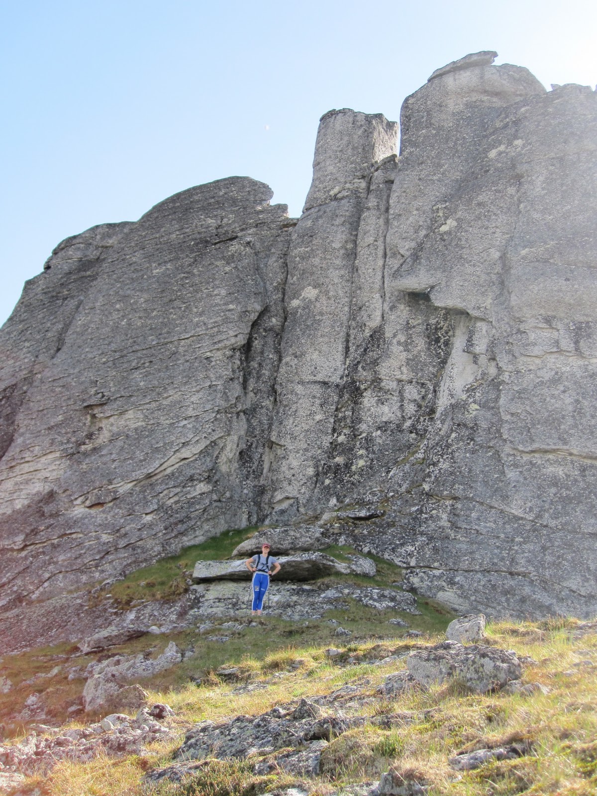
This is a big picture of some of the tors that are on the ridge to the summit. These tors (see link) are formed by slowly cooling igneous rock under the earth's surface that is gradually exposed to the surface over thousands of years as the softer metamorphic and sedimentary rock erodes away. The granite that makes up the tors is more resistant to erosion than the surrounding rock and large spires of the rock protrude from hills and ridges formed by the largely concealed pluton, of which the tors are a part of.  These particular tors are famous because they offer a great adventure for rock climbers. 


Here are more tors on the ridge leading to the summit. It's hard to see their size, but they are huge and very cool. 


Nearing the top of the summit the ridge became more of talus slope. The peak in the background on the left is the actual summit. 


This is a view from the ridge.


 And another view from the ridge


Proof that we made it to the top


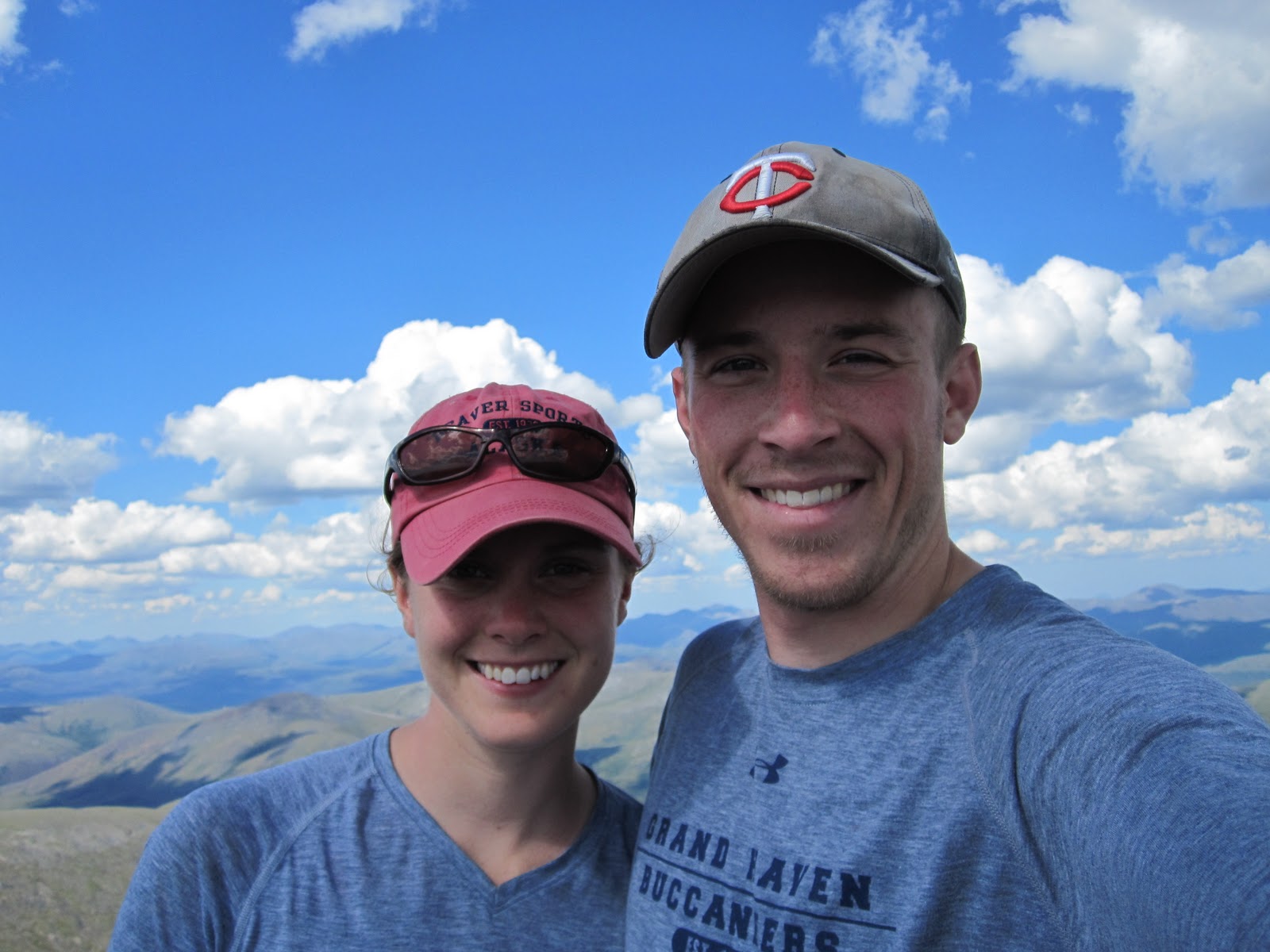
The classic picture that Joel and I like to take at the top of every mountain we reach


Joel framed in between two tors


The valley that we walked up. 


Joel finishing the hike through the valley. And look fairly sunny blue skies... success! Ohh yeah it started raining and thundering when we got back to the car... 

Julia's Perspective

Joel and I haven't been so up to date with out blog posts mainly due to lack of internet at our apartment. However, we are housesitting for the next little while and I am planning to take advantage of the internet at our "houses" to add some detail to our blog.

In Joel's last post he quickly recorded the adventures that we had this summer and early fall. I'm going to use some posts to add to those adventures with my perspective. Today I will talk about the Mount Prindle hike.

Joel and I attempted Mount Prindle on a Saturday. The weather forecast was for isolated thunderstorms, but in our Fairbanks experience "isolated thunderstorms" usually means bright blue skies. Thus we made the 1.5ish hour drive to the Mt. Prindle trail head. The hike to the top of Prindle is 9ish miles one way. Joel and I planned to run most/part of the trail and hike the steep parts. The trail was narrow and very wet from late snow melt and we ended up walking most of it. The first 5 miles of the hike is rather flat through a valley and then goes up to a ridge which takes you to the summit.


Here is a picture of the valley that we hiked through. You can see that the trail is a little damp. You can also see that our prediction of "clear blue skies" was a little off. 


And these are the clouds that forced us to turn around and end the hike early. I know these clouds don't look too bad, but they were more threatening than they look. Also there was lightning. We also were only prepared for a day hike and didn't have "foul weather gear". 

Though we didn't get to the peak we did make the drive worth it by stopping at the Chatanika gold dredge. The dredge is technically on private property, but there is a pretty good beaten down path to it. 


There are a couple of dredges around Fairbanks. Most of them are on "private" property, but private is more like a "guideline" here in AK. Needless to say Joel and I have been to two of them. They're huge by the way. 


Joel is the little white thing standing on the dredge next to the ladder. It might give you some perspective as to how big it is. You can also see that the graffiti and ladder suggest the how guideline like "private property" signs are. Joel explored inside, but I preferred to sit on the hill and fret about our illegal actions. My nerves were settled more when we ran into a whole family headed out to see the dredge. At least we weren't the only ones who were going to get in trouble for breaking the law...

Needless to say we learned from this trip that "isolated thunderstorms" does not always mean "clear blue skies". Our new perspective on Fairbanks forecast is that you can have "bright blue skies" when the forecast is "isolated thunderstorms"... when you're in the right place at the right time... Is that how it is in your part of the world too?